|
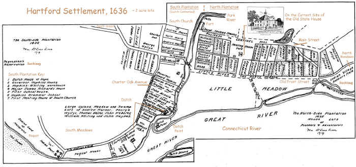
1636:
Hartford's
Founding English Settlement: 
Click map for enlargement.
Original plates combined - from: The
Colonial History of Hartford on-line
(added notations in brown)
Dutchman Adrien Block explored the CT River in
1614, and established a trading post in Hartford in 1633. This
followed the epidemics that destroyed 90% of the native population
along the Eastern Seaboard of North and South America. The
Suckiaug inhabited this area.
Englishman The Rev. Thomas Hooker's church was
established in Cambridge, MA in 1632 and 4 years later,
he lead over 100 English colonists and 120 cattle here, in part to
establish an English beachhead in Connecticut, and in part to
establish his own flavor of Puritanism (Congregationalism) -
without mandatory membership. Hooker renamed the settlement
after Hertford, England.
The settlement of Hartford occurred amidst
the Indian wars between the Pequot and Mohawk (who wanted to trade
exclusively with the Dutch), and the English, Dutch and Pequot -
vying for control over Connecticut. Within a year, the three
river towns of Hartford, Wethersfield and Windsor joined together
to fight the Pequot attack on Wethersfield, and created a common
court in Hartford. Within two years, the new plantation of
Springfield became part of the common court in Hartford.
Freemen voted to establish their first constitutional government
based on "the will of the people" with the Fundamental
Orders of 1639.
The settlement map shows 50 original property
owners, most of them part of Hooker's congregation, many highly
educated, and all seeking land to raise cattle and make their
family fortunes. Most of their names are familiar to us 350 years
later. Their homes were located between what is now Main
Street and the Connecticut River. The Little River (now
the Park River) divided the city north and south into two separate
plantations. They purchased their lots from the
Suckiaug who needed an ally against the Pequot. The Dutch also
claimed the south side of the Park River.
Jump to detail:
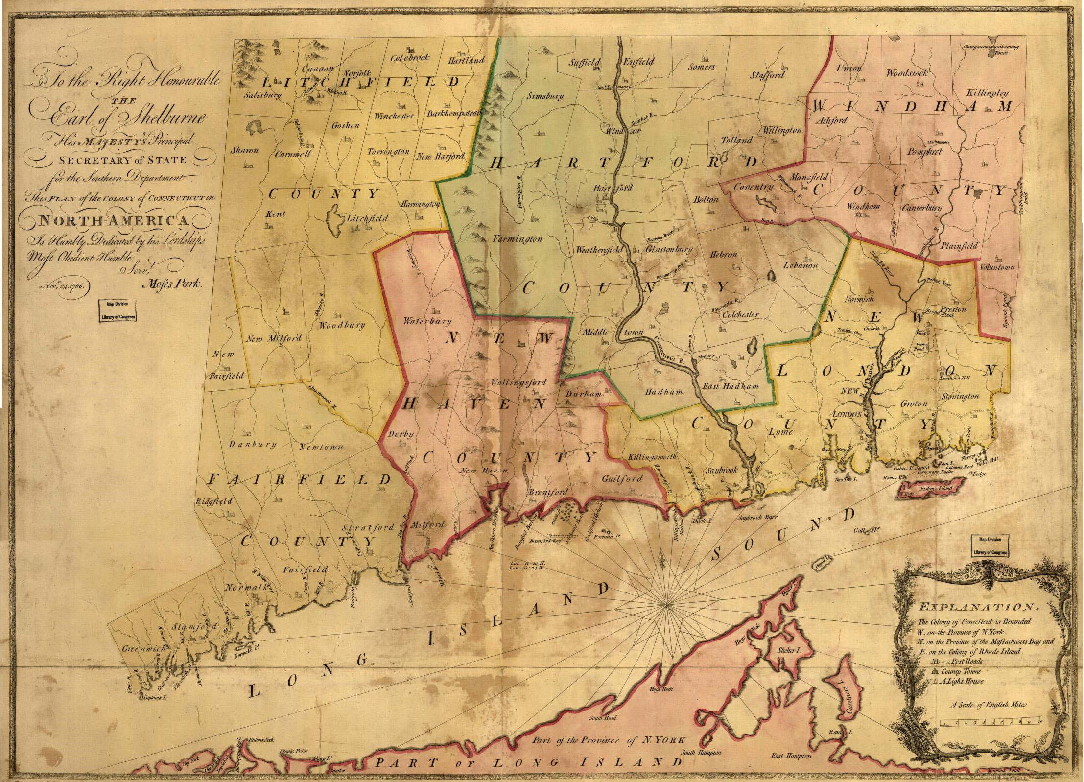
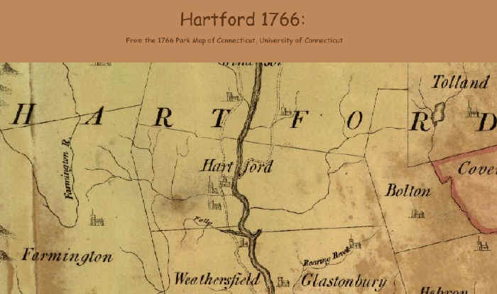
1755-1766:
Hartford's Pre-Revolutionary
Period:
In pre-revolutionary CT, Hartford is the crossing point for the
Post Road going up the east
and west side of the
CT River into Massachusetts, through Springfield to Boston and south
through New Haven, then west to Danbury and south to New York.
The shoreline post road goes to Providence, R.I.
These historic post roads mirror present-day I-91 inland and
I-95 along the shore.
Below are the Thomas Jefferies map of the northeast, 1755,
and the
Miles Park map executed for the Earl of Shelborne, His Majesty's Secretary of
State -
"The Colony of Connecticut, North America, 1766".
Click maps for enlargement
.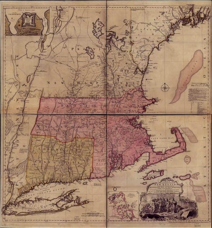
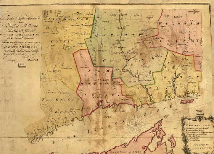
The original footprint for Hartford included
present-day West
Hartford, East Hartford and Manchester.
East Hartford will split off in 1783, including Manchester, which
will incorporate in 1823.
West Hartford is part of Hartford for the first 215 years, until
1854.
The meeting house and two churches are shown in Hartford:
currently Center Church and South Congregational churches.
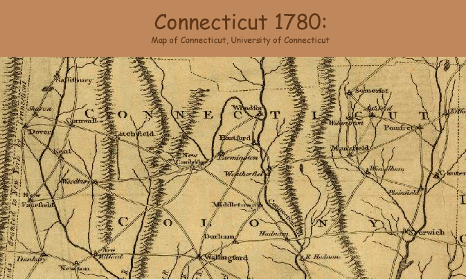
1776-1796:
Hartford's Revolutionary Period
By 1776, the beginning of the Revolution, the
major roads in the state appear much as they did twenty years
earlier.
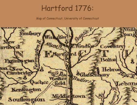
A map dated 1780 shows
Farmington Avenue extending from Hartford all the way to
Fairfield.
The current cities of West Hartford, East Hartford and Manchester are still part of
Hartford.
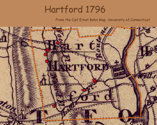
Bohn's 1796 map shows the Wells Ferry crossing at
Hartford. In addition to the town center, there are four grist mills, 2 saw mills, an oil mill and a paper
mill in Hartford.
Four roads fan out from Hartford (Albany, Asylum,
Farmington and New Britain avenues).
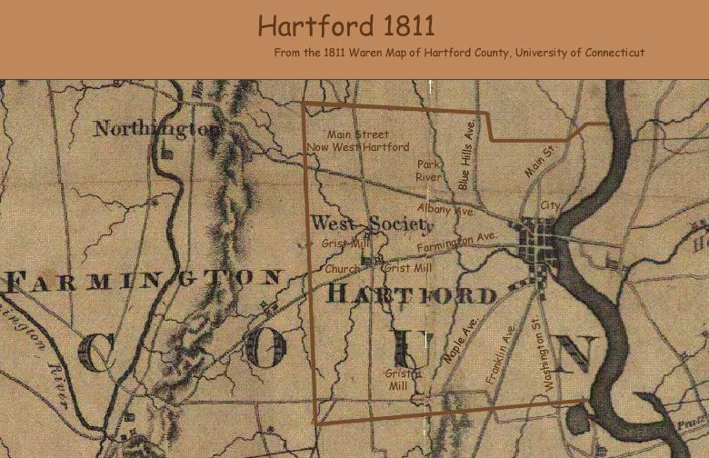
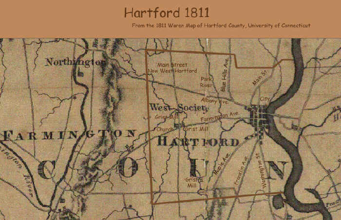
1811:
Hartford During the British Embargo
By 1811, the developed core city has spread
a couple of blocks in each direction. Major homes are along
Washington Street and Maple Avenue. The Warren map shows only three grist mills in the city, a
reduction in small manufacturing within the city limits, compared to 15 years
before.
This is a period of British embargo spurring small manufacturing
everywhere throughout New England. But Hartford has
developed as a major shipping port - the most northerly navigable
point in the CT River.
Now eight major roads form the routes to towns outside of the City
of Hartford.
The first bridge across the CT River at Hartford was built the
year before, in 1810. It was an uncovered bridge made of
wood. It will be washed away in the flooding of 1818, and
replaced with a covered bridge.
Click map for enlargement.
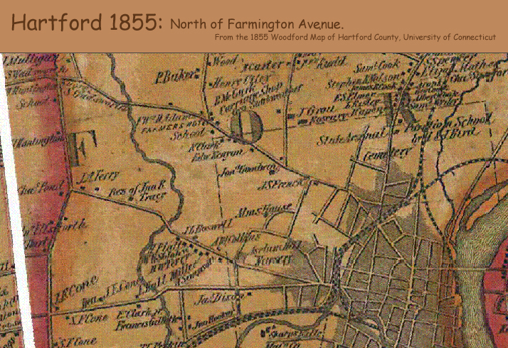
1855:
Hartford in the Industrial
Revolution
Samuel Colt
gets his own factory in 1847 on Pearl Street. He is 32,
finally able to control his own product patented 11 years
earlier. Colt's manufacturing genius was to perfect the
concept of interchangeable parts - 80% of his gun was made by
machine alone. He hired Elisha Root as head superintendent
from the Collinsville Axe Co. By 1855 Colt builds his
spectacular armory along the Connecticut River, designed and
constructed by Root who would go on to train a generation of
engineers including Pratt and Whitney.
The railroad from Hartford to New Haven (1839),
skirts downtown and connects with a spur
to steamship service from the Hartford dock to New York.
There has been rail service to Boston for 9 years and to New York
for seven.
The path of the railway will define the highway footprint
constructed 100 years later.
The
West End in 1855:
By now, urban development has spread west
out to Flower Street, on the eastern edge of what is now Aetna.
The year before, West Hartford split off and
incorporated as a separate town, making Hartford's west boundary Prospect Avenue.
There are thirteen homes located in what is now the West End, all
of them along the only streets: Albany, Bloomfield, Farmington,
Asylum and Prospect - all
major routes from the city to other towns. The rest of the
land is primarily flat farmland divided by whitewashed wooden
fences.
Jump to the Farmington Avenue Business District
History page on Facebook:
1869:
Hartford after
the Civil War
Fifteen years later, the city has expanded west
into the current Asylum Hill neighborhood. It is 4 years
after the Civil War, and Hartford is still a major port city -
with 22 piers. Bushnell Park has just been built.
Harriett Beecher Stowe, world famous author of Uncle Tom's
Cabin (1851), moves to "Nook Farm" in Hartford
in1873. Mark Twain builds his house next door to her in 1874, and
publishes Tom Sawyer two years later.
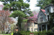
The West End in
1869:
Fourteen years later, there are only 10 more houses in the West End - now totaling
23, and one more street has been added in the neighborhood - Sisson
Avenue. The area, then known as "Middle District', is still mostly
farmland.
Next year, Eugene Kenyon will build a path north of his home on
Farmington Avenue and build his farm house halfway up what is now
the first block of Kenyon Street (now 96 Kenyon).
It will be the first home in the neighborhood built off of one of
the major avenues.
Click map for enlargement, or click for pdf
file.
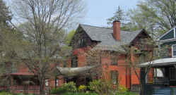
1896:
Hartford's Gilded Age
The covered bridge across the
Connecticut River burned the year before in 1895. The current Bulkeley Bridge is a stone arch bridge that opened
thirteen years later in
1908. It is one of the oldest bridges in use by the interstate
highway system (I-84).
The
West End in 1896:
xxx
Click map for enlargement, or click for pdf
file.
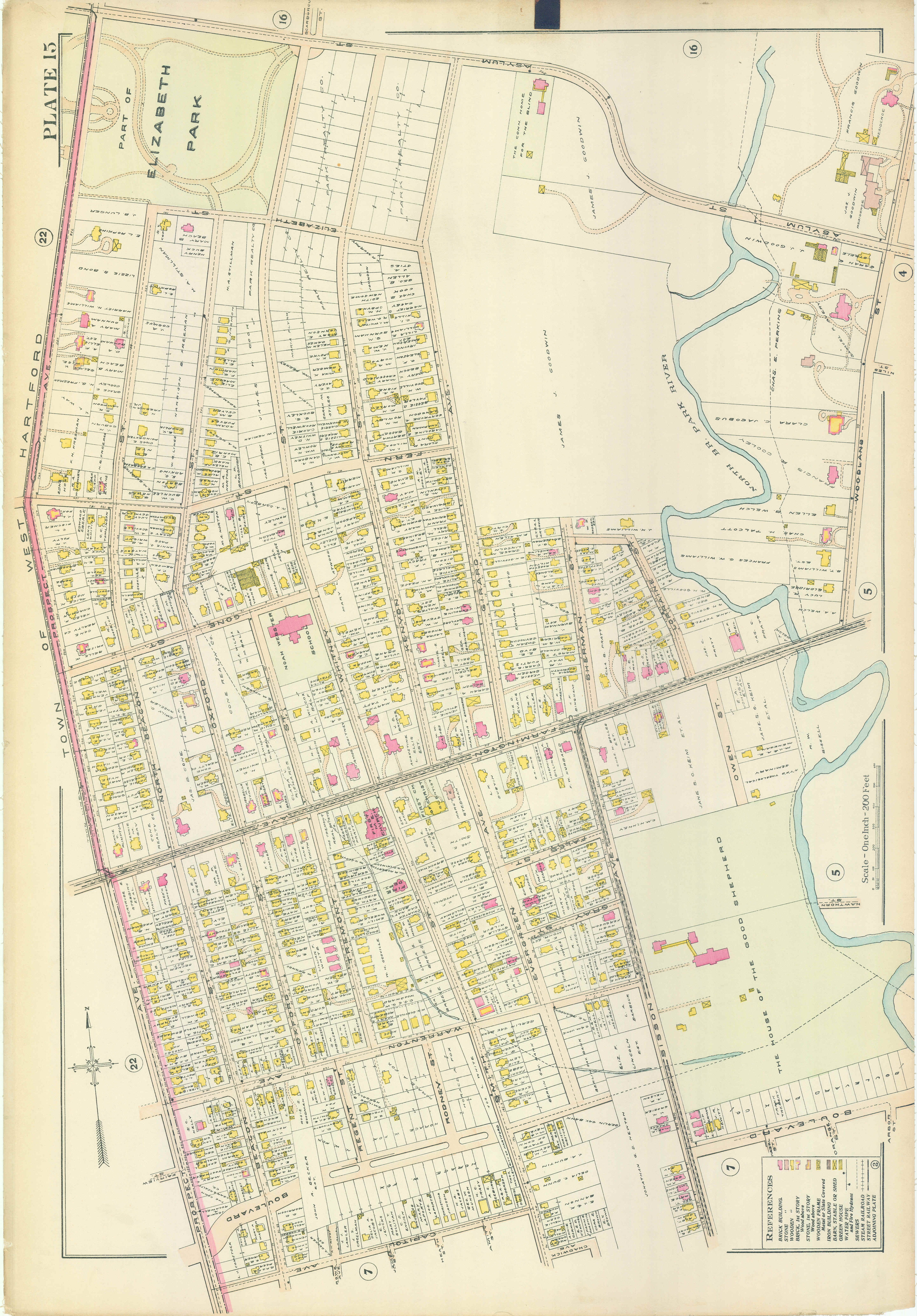
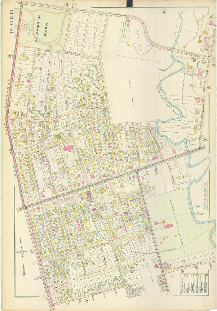
1909:
Hartford is fully urbanized
Hartford
The
West End in 1896:
xxx
Click map for enlargement, or click for pdf
file.
Many thanks to the Hartford
Preservation Alliance for the loan of the last three original
city plates from 1869-1909.
Maps digitized by C. West Designs.
The 1636 map appears in The
Colonial History of Hartford, William DeLoss Love, 1914.
Thanks to the University of Connecticut for the early maps of
Connecticut: 1766-1855.
|